Geopark
a Vast Heritage Site From Antiquity
A geopark is a natural park containing geological heritage. It ...
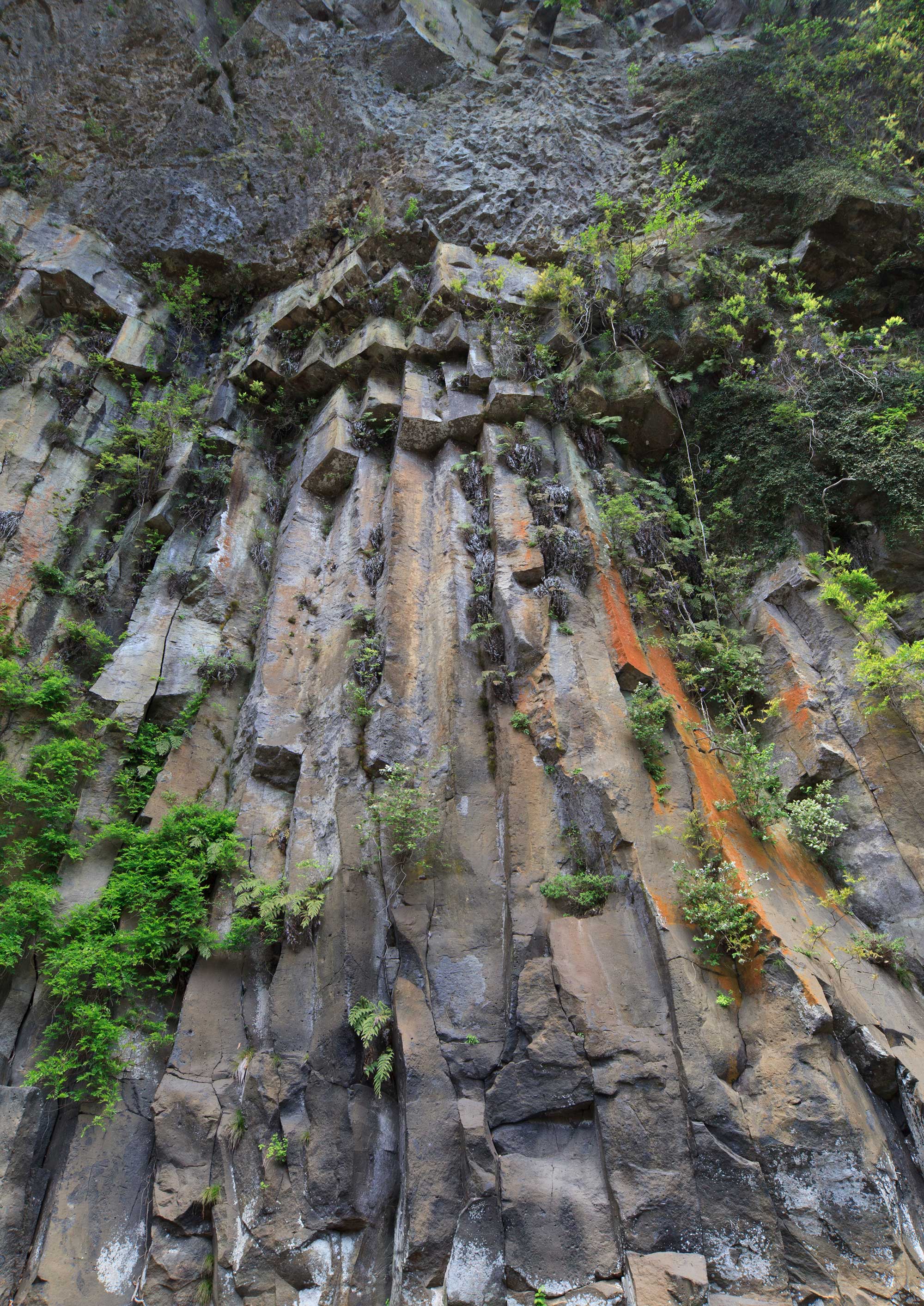
Takkiri Ravine
a Cool Trekking Route
Takkiri Ravine is located in a nook of one of the ten gorges of Yabakei, Shiiya Yabakei Gorge. When people hear Shiiya,...
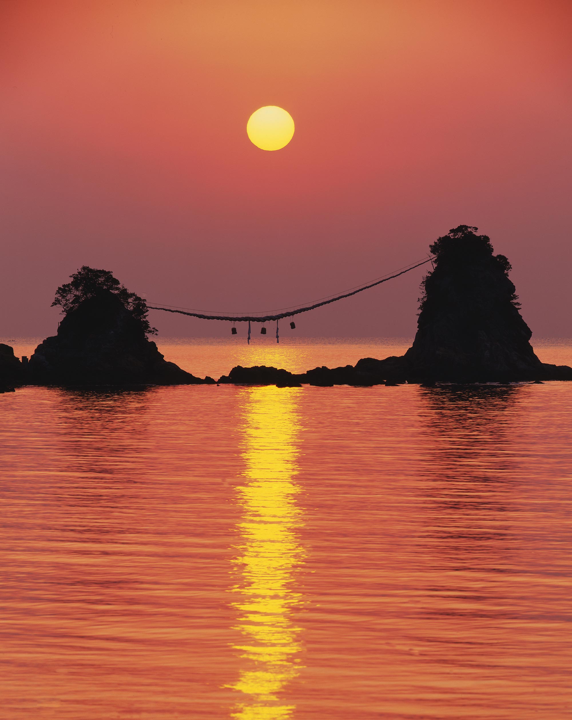
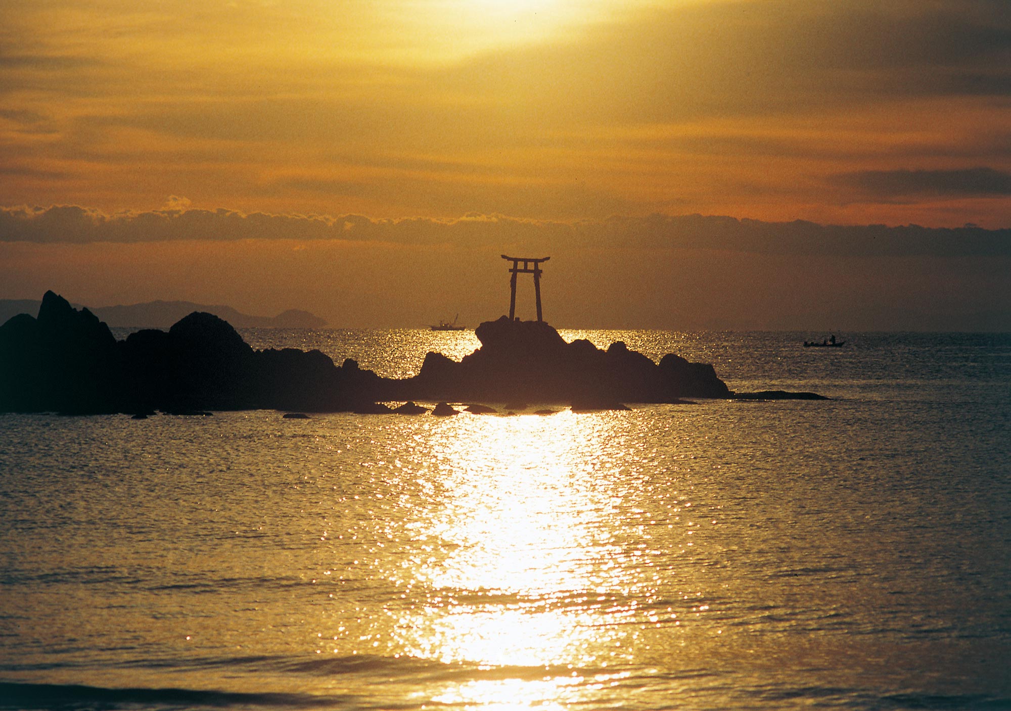
Bungo Futamigaura
Rocks of Male and Female that Stand Out
The New Year is here. Bungo Futamigaura (Kamiura, Saiki) is one of the most famous places to view the first sun...
Mizunoko Island’s Lighthouse
the Guardian God of the Departing Vessels
The island is just as its name suggests – “Mizunoko (a child of water).” It is a child of the Bungo Channel tha...
Poison Bulb Cluster on Yonouzu Hazako Coast
Lady Swaying in Sea Breeze
Poison Bulb (Crinum asiaticum) is a representative plant of the “paradise of the Black Current.” It grows natur...
Furen Limestone Cave
Japan’s Most Beautiful
In the southern part of Oita lies the limestone mountains. Tsukumi is famous for mining and the karst tableland of Hach...
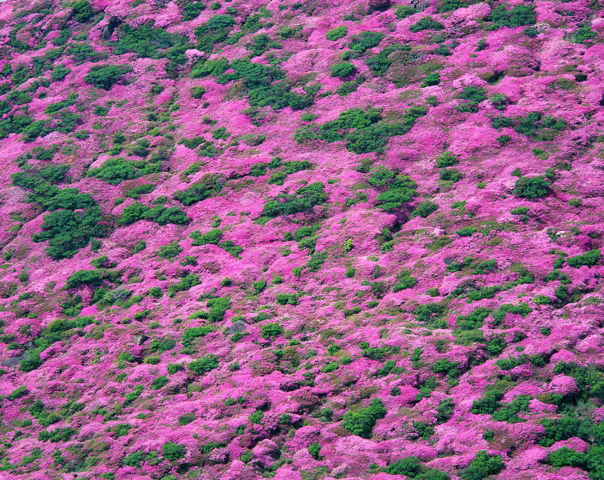
Kyushu Azalea (Miyama Kirishima) in the Kuju Mountain Ridge
Full Bloom in Pink
As the famous song Bogatsuru Sanka goes, “Kyushu Azalea (Miyama Kirishima) in full bloom, making the mountain blush…,” ...
Harajiri Falls
Nicknamed "Niagara"
The central area of Ogata, Bungo Ono is called “Ogata Gosengoku (5,000 koku worth of rice field),” known for its rice c...
Chinda Falls
Stunning Waterfalls in Works of Sesshu
Chinda Falls are located in the main stream of Ono River, in the border of the two towns Ono and Kiyokawa, in Bungo Ono...
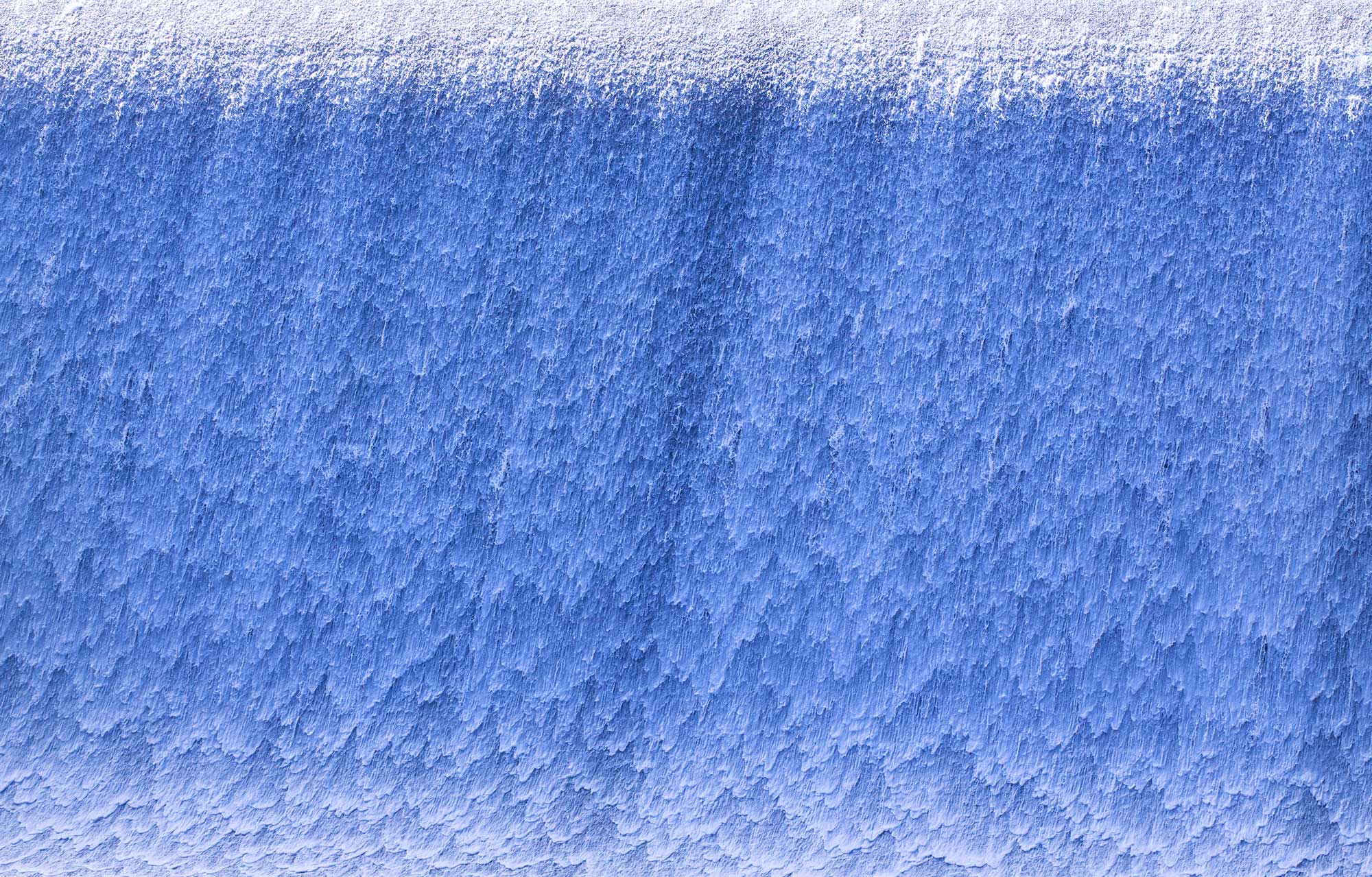
Hakusui Dam
the Soothing Bubble Patterns
The cherry blossoms in spring, lush green of the forest and thunderous clouds in summer, the autumn leaves, and the win...
Ao-no-Doumon Tunnel and Kyoushu Peak
Created by Rock Formations and the Human Hand
Though called by the single name Yabakei Valley, this area is actually fairly expansive. The range nationally designate...
Mount Hane and Mount Kirikabu
Heart-warming Flat Top Mountains
Standing in the middle of the Kusu Basin looking around, you will feel naturally relaxed. The surrounding mountains are...
Kokonoe "Yume" Otsurihashi and Kyusuikei Valley
a Stunning Panoramic View
At the northern end of the plateau of Iida Highlands in Kokonoe, spreading out at the foot of the Kuju Mountain, the la...
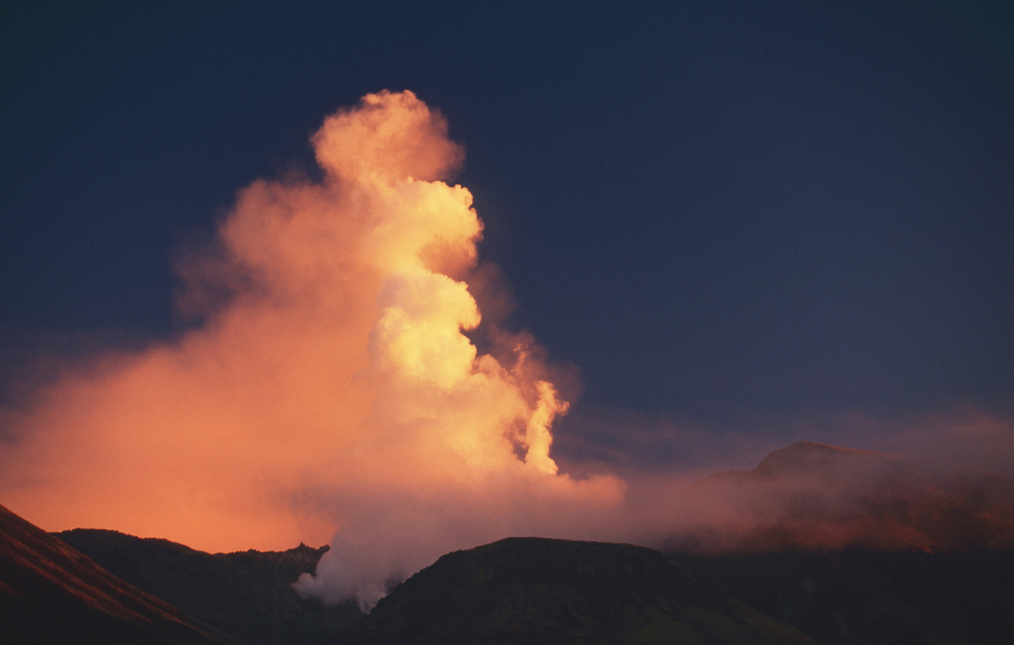
Mount Iou
Continuously Fuming
It is the magnificent fumaroles of Mount Iou that proves that the Kuju Mountain Ridge is still strongly established as ...
Hitome Hakkei
a Blend of Boulders, Trees, and Water
Yabakei Valley is mostly a mesa (table-shaped plateau). Yamakuni River and its tributaries have carved deep grooves int...
Uomi Zakura Cherry Tree
Portending the Fishing Season
Facing Beppu Bay where the spring tides come in is a south-facing slope bathed in sunlight. On that high ground among y...
The Road Francis Xavier Walked
a Gateway to Culture
Behind Beppu Bay’s north shore and Toyooka in Hiji are a mountain range made of fault scarp. In the center is the main ...
Pine Trees of Nada Coast
a High-Ranking Hachimangu Shrine
The rising sun glitters over Beppu Bay, sunlit waves crash on the shoals, and wind blows through the pine forest. This ...
Mount Kuro Native Forest and Oike
Lush Mountain of Mystery
There is a mountain covered with deep native forest on the east end of the Kuju Mountain Range. It looks black from a d...
Yufu River Gorge
Another World Full of Spiritual Energy
A huge groove carved sharply into the earth. It is about 12 kilometers long, 20 to 60 meters deep, and about 8 meters w...
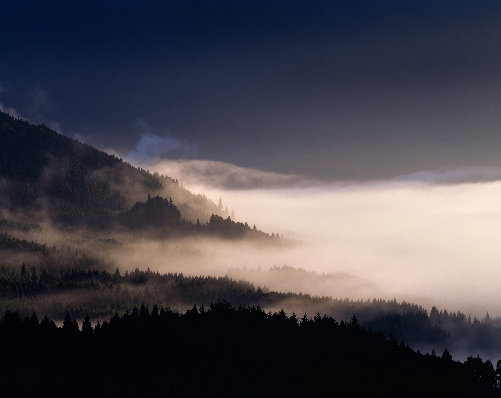
Yufuin Basin and Morning Fog
a White Lake Shrouding Mountain Villages
The season of morning mist is coming along with the cold air. The fog by radiative cooling rises around Lake Kinrin, fi...
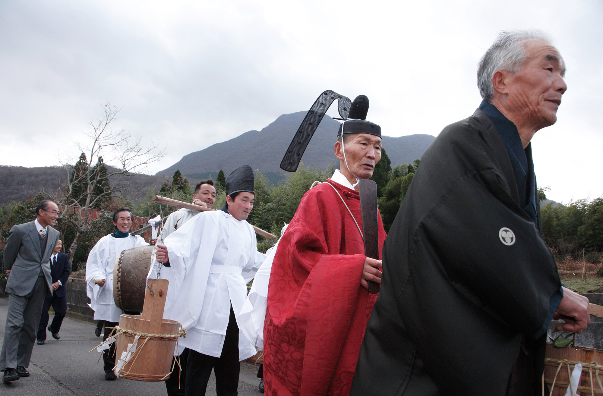
Tsukahara Highlands
Famous Amazake Festival
In the northern foothills of Mount Yufu, the “Fuji of Bungo,” sprawls a bright highland stretching 4 kilometers east to...
Burning Fields and Grasslands in the Southern Foothills of Mount Yufu
a Famous Mountain Fire Festival Heralding Spring
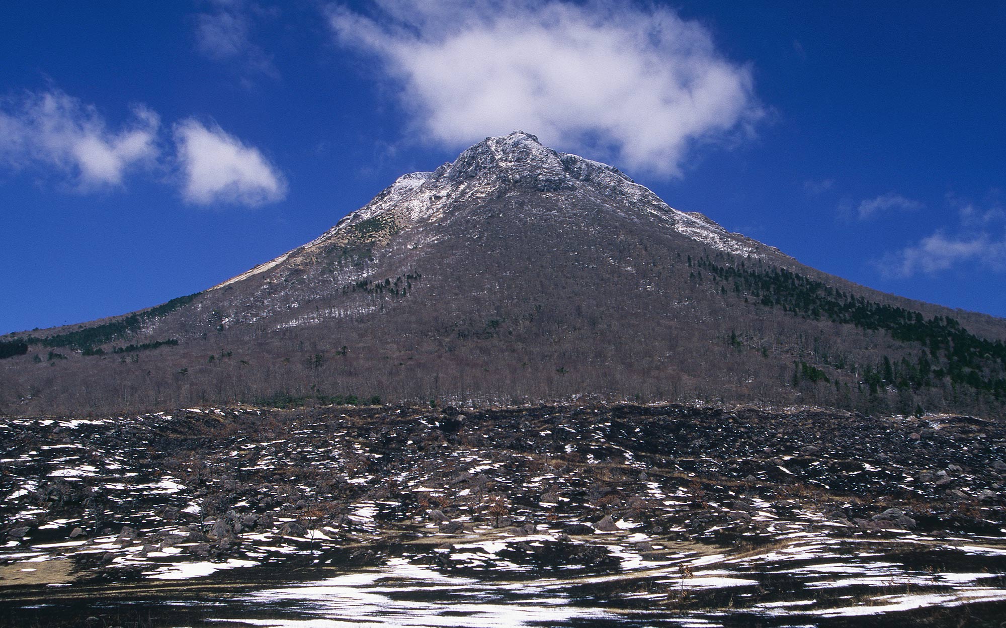
Called the Fuji of Bungo, Mount Yufu (altitude of 1583 meters) is a famous mountain symbolizing Oita Prefecture. Howeve...
The History and Landscape of the Mountains of Kunisaki Peninsula
a Treasure Trove of Shinto-Buddhism Syncretism
A round peninsula, shaped like a Japanese umbrella without its handle. Ridges and valleys extend radially in all direct...
Kagurame Lake
Flowers Coloring the Rainy Season
The Japanese iris suits the rainy season well. In June, nearly 300,000 flowers compete for beauty at Kagurame Lake in O...
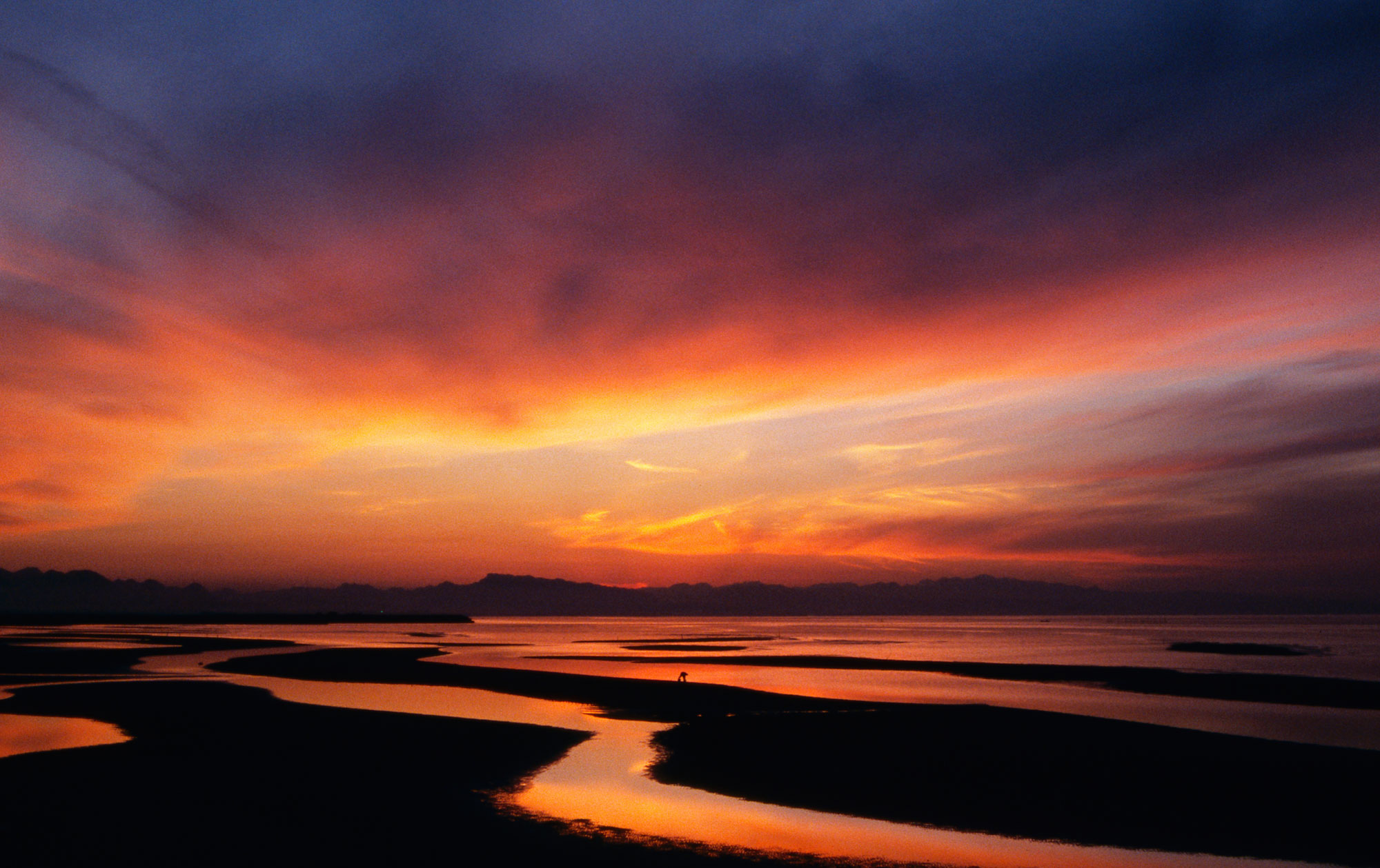
The Setting Sun Over Matama Coast
an Ever-Changing Radiance
On the western edge of Kunisaki Peninsula, the sun setting into the tidal flats of Matama (Bungotakada) creat...
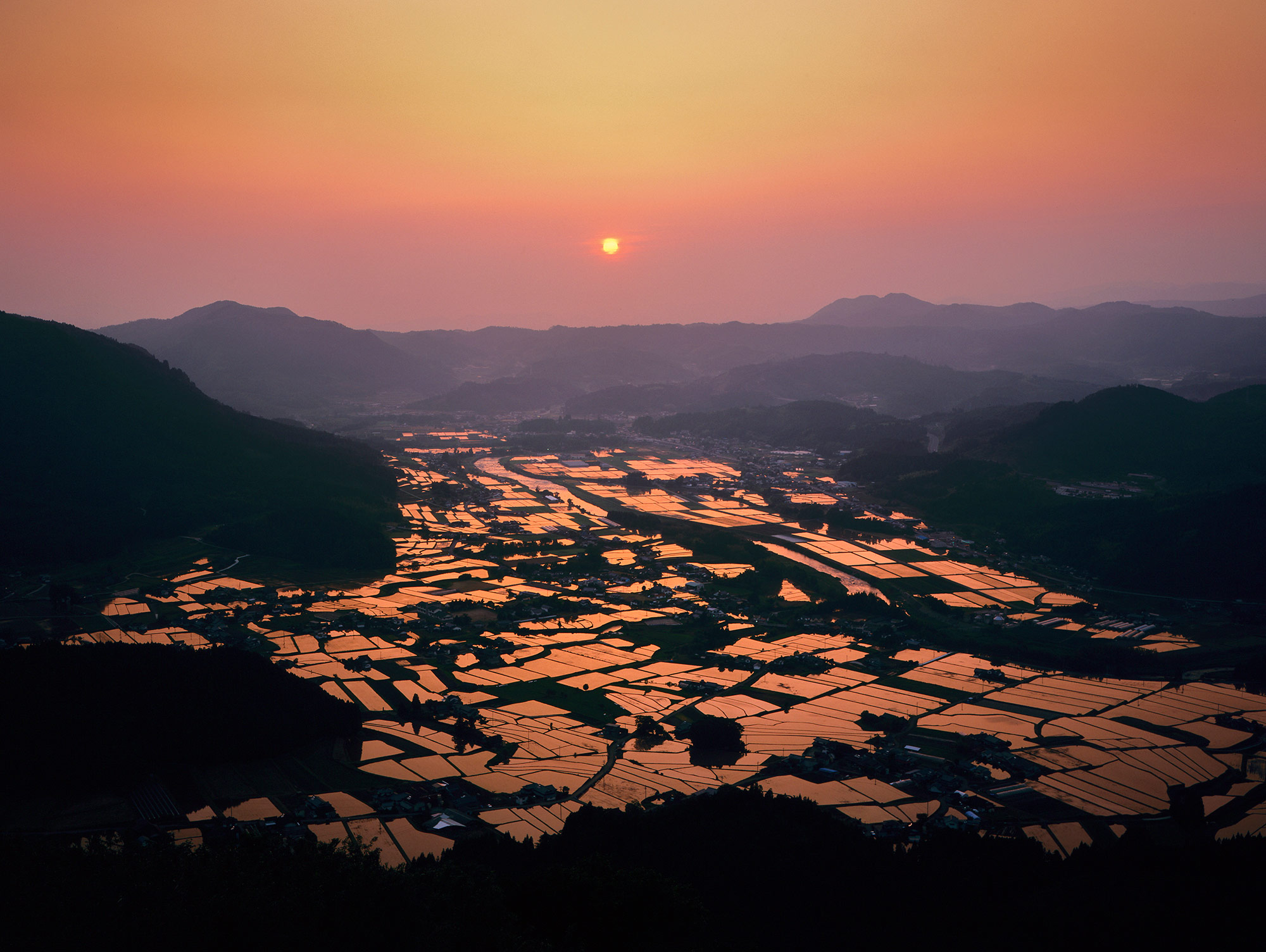
Tashibu-no-Shou
the Original Landscape of Japanese Agriculture
Upstream of the Katsura River flowing through Bungotakada in the southwestern part of the Kunisaki Peninsula ...
Nature and War Ruins of Takashima Island
Surrounded by Whirling Waves
At the tip of Saganoseki Peninsula, 3.5 kilometers offshore of Sekizaki (also known as Jizouzaki), Takashima Is...